
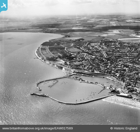
EAW017589 ENGLAND (1948). The Royal Harbour and part of the town, Ramsgate, 1948. This image has been produced from a print.
© Copyright OpenStreetMap contributors and licensed by the OpenStreetMap Foundation. 2026. Cartography is licensed as CC BY-SA.
Nearby Images (27)
EAW017589

EAW008999

EPW048858

EPW000600

EAW020486

EPW018646

EAW009050

EPW000596

EAW020487

EPW039353

EAW009009

EPW035449

EAW009007

EPW039354

EAW009006

EPW042864

EPW018650

EAW015836

EAW009008

EPW000092

EPW042861

EAW017592

EPW042862

EAW009055

EPW000375

EPW000595

EAW015835

Details
| Title | [EAW017589] The Royal Harbour and part of the town, Ramsgate, 1948. This image has been produced from a print. |
| Reference | EAW017589 |
| Date | 22-July-1948 |
| Link | |
| Place name | RAMSGATE |
| Parish | RAMSGATE |
| District | |
| Country | ENGLAND |
| Easting / Northing | 638576, 164477 |
| Longitude / Latitude | 1.4250208351761, 51.328755008776 |
| National Grid Reference | TR386645 |
Pins

Alan McFaden |
Thursday 28th of August 2014 09:37:25 AM | |
|
Alan McFaden |
Thursday 28th of August 2014 09:36:37 AM | |
|
Alan McFaden |
Thursday 28th of August 2014 09:35:54 AM |


