
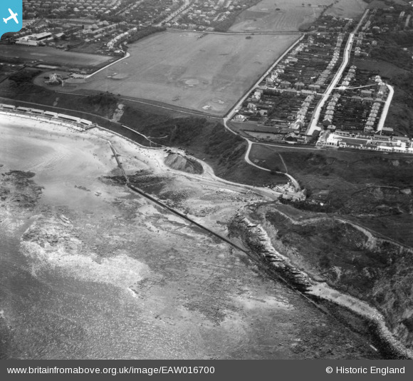
EAW016700 ENGLAND (1948). North Cliff Golf Course and Monkey Island, Scarborough, 1948
© Copyright OpenStreetMap contributors and licensed by the OpenStreetMap Foundation. 2026. Cartography is licensed as CC BY-SA.
Nearby Images (11)
EAW016700

EAW010306

EAW010300

EAW010299

EAW010304

EAW010303

EAW016707

EAW010305

EAW016708

EAW016701

EAW016705

Details
| Title | [EAW016700] North Cliff Golf Course and Monkey Island, Scarborough, 1948 |
| Reference | EAW016700 |
| Date | 23-June-1948 |
| Link | |
| Place name | SCARBOROUGH |
| Parish | |
| District | |
| Country | ENGLAND |
| Easting / Northing | 503565, 490772 |
| Longitude / Latitude | -0.40829416357322, 54.301886574521 |
| National Grid Reference | TA036908 |
Pins

Derek Lawley |
Tuesday 29th of September 2020 09:36:55 PM | |
|
minivanman1961 |
Tuesday 12th of November 2019 08:41:44 PM | |
|
Chris Kolonko |
Friday 12th of January 2018 01:18:13 PM | |
|
Al |
Sunday 5th of March 2017 06:38:57 PM | |
|
The Laird |
Tuesday 2nd of June 2015 05:10:04 PM | |
|
Al |
Monday 19th of May 2014 04:55:37 PM |