
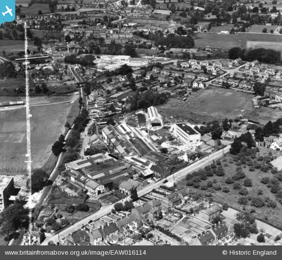
EAW016114 ENGLAND (1948). The Lightpill Iron Works and Dudbridge Road, Lightpill, 1948. This image has been produced from a print marked by Aerofilms Ltd for photo editing.
© Copyright OpenStreetMap contributors and licensed by the OpenStreetMap Foundation. 2026. Cartography is licensed as CC BY-SA.
Nearby Images (9)
EAW016114

EAW016109

EAW016112

EAW016116

EAW016115
, Lightpill, from the north-east, 1948. This image has been produced from a damaged negative.")
EAW016111

EAW016113

EAW016110

EAW006435

Details
| Title | [EAW016114] The Lightpill Iron Works and Dudbridge Road, Lightpill, 1948. This image has been produced from a print marked by Aerofilms Ltd for photo editing. |
| Reference | EAW016114 |
| Date | 21-May-1948 |
| Link | |
| Place name | LIGHTPILL |
| Parish | RODBOROUGH |
| District | |
| Country | ENGLAND |
| Easting / Northing | 383960, 204328 |
| Longitude / Latitude | -2.2323106279173, 51.736974340133 |
| National Grid Reference | SO840043 |
Pins
Be the first to add a comment to this image!