
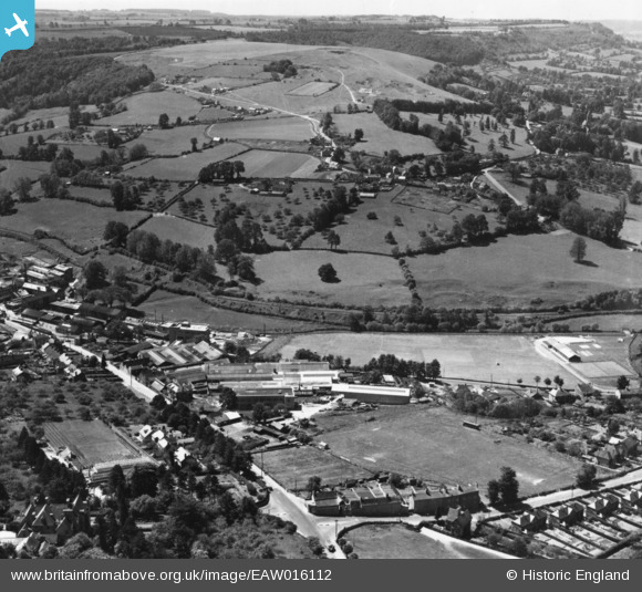
EAW016112 ENGLAND (1948). The Lightpill Iron Works and Selsey, Lightpill, from the north-east, 1948. This image has been produced from a print.
© Copyright OpenStreetMap contributors and licensed by the OpenStreetMap Foundation. 2026. Cartography is licensed as CC BY-SA.
Nearby Images (12)
EAW016112

EAW016114

EAW016111

EAW016116

EAW016109

EAW016115
, Lightpill, from the north-east, 1948. This image has been produced from a damaged negative.")
EAW016113

EAW006435

EAW016110

EAW006429

EAW006431

EAW006427

Details
| Title | [EAW016112] The Lightpill Iron Works and Selsey, Lightpill, from the north-east, 1948. This image has been produced from a print. |
| Reference | EAW016112 |
| Date | 21-May-1948 |
| Link | |
| Place name | LIGHTPILL |
| Parish | RODBOROUGH |
| District | |
| Country | ENGLAND |
| Easting / Northing | 383928, 204275 |
| Longitude / Latitude | -2.2327716378281, 51.736496843477 |
| National Grid Reference | SO839043 |
Pins
Be the first to add a comment to this image!