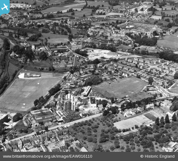
EAW016110 ENGLAND (1948). The Lightpill Iron Works, Dudbridge Road and environs, Lightpill, 1948. This image has been produced from a print.
© Copyright OpenStreetMap contributors and licensed by the OpenStreetMap Foundation. 2026. Cartography is licensed as CC BY-SA.
Nearby Images (10)
Details
| Title | [EAW016110] The Lightpill Iron Works, Dudbridge Road and environs, Lightpill, 1948. This image has been produced from a print. |
| Reference | EAW016110 |
| Date | 21-May-1948 |
| Link | |
| Place name | LIGHTPILL |
| Parish | RODBOROUGH |
| District | |
| Country | ENGLAND |
| Easting / Northing | 383848, 204427 |
| Longitude / Latitude | -2.2339373291743, 51.737861337411 |
| National Grid Reference | SO838044 |
Pins

Lyndon Smith |
Tuesday 16th of December 2025 10:44:51 PM | |

Robert |
Sunday 20th of February 2022 12:29:09 PM | |

Robert |
Sunday 20th of February 2022 12:27:53 PM | |

Robert |
Saturday 19th of February 2022 11:34:55 PM | |

Robert |
Saturday 19th of February 2022 11:32:48 PM |


![[EAW016110] The Lightpill Iron Works, Dudbridge Road and environs, Lightpill, 1948. This image has been produced from a print.](http://britainfromabove.org.uk/sites/all/libraries/aerofilms-images/public/100x100/EAW/016/EAW016110.jpg)
![[EAW016114] The Lightpill Iron Works and Dudbridge Road, Lightpill, 1948. This image has been produced from a print marked by Aerofilms Ltd for photo editing.](http://britainfromabove.org.uk/sites/all/libraries/aerofilms-images/public/100x100/EAW/016/EAW016114.jpg)
![[EAW016109] The Lightpill Iron Works and environs, Lightpill, 1948. This image has been produced from a print.](http://britainfromabove.org.uk/sites/all/libraries/aerofilms-images/public/100x100/EAW/016/EAW016109.jpg)
![[EAW016112] The Lightpill Iron Works and Selsey, Lightpill, from the north-east, 1948. This image has been produced from a print.](http://britainfromabove.org.uk/sites/all/libraries/aerofilms-images/public/100x100/EAW/016/EAW016112.jpg)
![[EPW041881] Paynes Place, Dudbridge Lane and environs, Rodborough, 1933](http://britainfromabove.org.uk/sites/all/libraries/aerofilms-images/public/100x100/EPW/041/EPW041881.jpg)
![[EAW016116] The Lightpill Iron Works, Lightpill, 1948. This image has been produced from a print.](http://britainfromabove.org.uk/sites/all/libraries/aerofilms-images/public/100x100/EAW/016/EAW016116.jpg)
![[EAW016115] The Lightpill Iron Works (site of), Lightpill, from the north-east, 1948. This image has been produced from a damaged negative.](http://britainfromabove.org.uk/sites/all/libraries/aerofilms-images/public/100x100/EAW/016/EAW016115.jpg)
![[EAW016111] The Lightpill Iron Works, Lightpill Mills and environs, Lightpill, 1948. This image has been produced from a print.](http://britainfromabove.org.uk/sites/all/libraries/aerofilms-images/public/100x100/EAW/016/EAW016111.jpg)
![[EAW016113] The Lightpill Iron Works, Lightpill, 1948. This image has been produced from a print.](http://britainfromabove.org.uk/sites/all/libraries/aerofilms-images/public/100x100/EAW/016/EAW016113.jpg)
![[EPW041882] Paynes Place, Bath Road and environs, Rodborough, 1933](http://britainfromabove.org.uk/sites/all/libraries/aerofilms-images/public/100x100/EPW/041/EPW041882.jpg)