
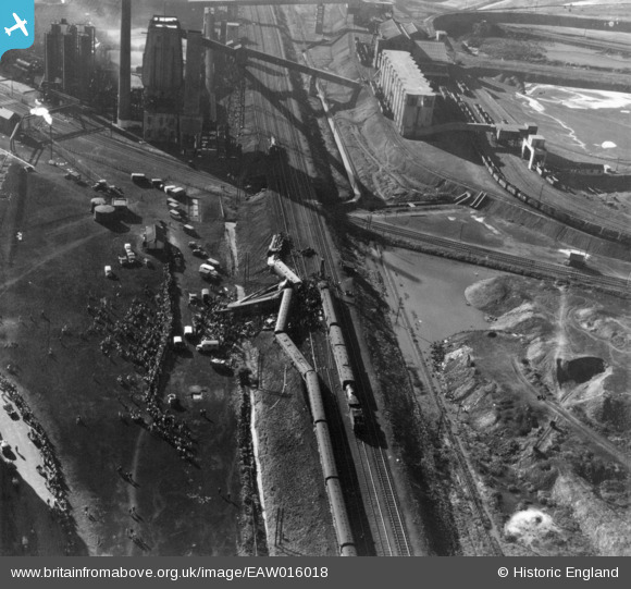
EAW016018 ENGLAND (1948). The Wath Road Junction Derailment, Wath upon Dearne, 1948. This image has been produced from a print.
© Copyright OpenStreetMap contributors and licensed by the OpenStreetMap Foundation. 2026. Cartography is licensed as CC BY-SA.
Nearby Images (12)
EAW016018

EAW016019

EAW016016

EAW015601

EAW015597

EAW015600

EAW015602

EAW015599

EAW016021

EAW016017

EAW016020
, Wath upon Dearne, 1948. This image has been produced from a damaged negative.")
EAW015598

Details
| Title | [EAW016018] The Wath Road Junction Derailment, Wath upon Dearne, 1948. This image has been produced from a print. |
| Reference | EAW016018 |
| Date | 19-May-1948 |
| Link | |
| Place name | WATH UPON DEARNE |
| Parish | |
| District | |
| Country | ENGLAND |
| Easting / Northing | 445213, 400927 |
| Longitude / Latitude | -1.3182725428868, 53.502841373501 |
| National Grid Reference | SE452009 |
Pins
Be the first to add a comment to this image!