
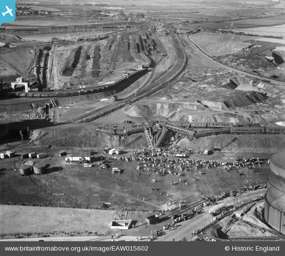
EAW015602 ENGLAND (1948). The Wath Road Junction Derailment, Wath Upon Dearne, 1948
© Copyright OpenStreetMap contributors and licensed by the OpenStreetMap Foundation. 2026. Cartography is licensed as CC BY-SA.
Nearby Images (12)
EAW015602

EAW016016

EAW016018

EAW015600

EAW016019

EAW015597

EAW015601

EAW015599

EAW016017

EAW016020
, Wath upon Dearne, 1948. This image has been produced from a damaged negative.")
EAW016021

EAW015598

Details
| Title | [EAW015602] The Wath Road Junction Derailment, Wath Upon Dearne, 1948 |
| Reference | EAW015602 |
| Date | 19-May-1948 |
| Link | |
| Place name | WATH UPON DEARNE |
| Parish | |
| District | |
| Country | ENGLAND |
| Easting / Northing | 445246, 400939 |
| Longitude / Latitude | -1.3177732714641, 53.502946400903 |
| National Grid Reference | SE452009 |
Pins

redmist |
Tuesday 22nd of January 2019 08:24:51 PM | |
|
redmist |
Tuesday 22nd of January 2019 08:22:52 PM | |
|
Brick Collector |
Saturday 25th of January 2014 10:14:56 PM | |
|
Brick Collector |
Saturday 25th of January 2014 10:12:01 PM |