
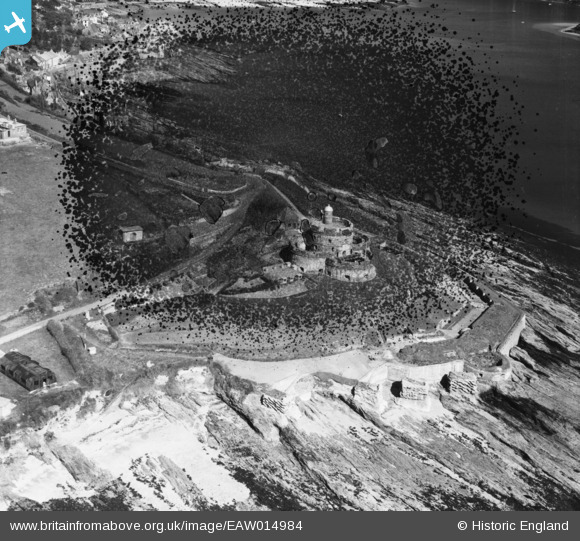
EAW014984 ENGLAND (1948). St Mawes Castle, St Mawes, 1948. This image has been produced from a damaged negative.
© Copyright OpenStreetMap contributors and licensed by the OpenStreetMap Foundation. 2026. Cartography is licensed as CC BY-SA.
Nearby Images (7)
EAW014984

EAW005984

EAW005982

EAW005980

EAW005981

EAW014985

EAW005983

Details
| Title | [EAW014984] St Mawes Castle, St Mawes, 1948. This image has been produced from a damaged negative. |
| Reference | EAW014984 |
| Date | 27-April-1948 |
| Link | |
| Place name | ST MAWES |
| Parish | ST. JUST-IN-ROSELAND |
| District | |
| Country | ENGLAND |
| Easting / Northing | 184097, 32767 |
| Longitude / Latitude | -5.0228470920431, 50.154951095817 |
| National Grid Reference | SW841328 |
Pins

Matt Aldred edob.mattaldred.com |
Tuesday 7th of July 2026 03:32:28 PM | |
|
Matt Aldred edob.mattaldred.com |
Tuesday 7th of July 2026 03:32:17 PM | |
|
Matt Aldred edob.mattaldred.com |
Tuesday 7th of July 2026 03:32:07 PM | |
|
Matt Aldred edob.mattaldred.com |
Tuesday 7th of July 2026 03:31:53 PM | |

redmist |
Monday 29th of August 2022 06:22:49 PM | |
|
CornwallPhil |
Monday 1st of September 2014 09:08:40 PM | |
|
CornwallPhil |
Monday 1st of September 2014 09:07:21 PM | |
|
CornwallPhil |
Monday 1st of September 2014 09:04:06 PM | |
|
CornwallPhil |
Monday 1st of September 2014 08:51:18 PM |
User Comment Contributions

WW2 features at St Mawes Castle |
CornwallPhil |
Monday 1st of September 2014 09:10:27 PM |

St. Mawes Castle from the St. Mawes to Falmouth ferry August 1965. A young Class31 and brother enjoy the view. |

Class31 |
Monday 19th of May 2014 08:58:01 AM |