
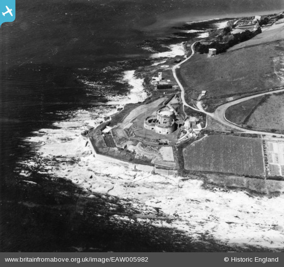
EAW005982 ENGLAND (1947). St Mawes Castle and Castle Point, St Mawes, 1947. This image has been produced from a print.
© Copyright OpenStreetMap contributors and licensed by the OpenStreetMap Foundation. 2026. Cartography is licensed as CC BY-SA.
Nearby Images (7)
EAW005982

EAW005984

EAW005980

EAW014984

EAW005983

EAW005981

EAW014985

Details
| Title | [EAW005982] St Mawes Castle and Castle Point, St Mawes, 1947. This image has been produced from a print. |
| Reference | EAW005982 |
| Date | 18-May-1947 |
| Link | |
| Place name | ST MAWES |
| Parish | ST. JUST-IN-ROSELAND |
| District | |
| Country | ENGLAND |
| Easting / Northing | 184098, 32740 |
| Longitude / Latitude | -5.0228178075778, 50.154708944502 |
| National Grid Reference | SW841327 |
Pins

Matt Aldred edob.mattaldred.com |
Tuesday 7th of July 2026 03:33:19 PM | |
|
Matt Aldred edob.mattaldred.com |
Tuesday 7th of July 2026 03:32:58 PM | |

redmist |
Monday 29th of August 2022 06:55:25 PM | |
|
redmist |
Wednesday 25th of November 2020 01:57:16 PM | |
|
CornwallPhil |
Saturday 6th of September 2014 09:43:35 PM | |
|
CornwallPhil |
Saturday 6th of September 2014 09:43:02 PM | |
|
CornwallPhil |
Saturday 6th of September 2014 09:41:32 PM | |
|
CornwallPhil |
Saturday 6th of September 2014 09:40:16 PM | |
|
CornwallPhil |
Saturday 6th of September 2014 09:39:44 PM | |
|
CornwallPhil |
Saturday 6th of September 2014 09:37:30 PM |
User Comment Contributions

World War Two features at St Mawes Castle |
CornwallPhil |
Saturday 6th of September 2014 09:46:10 PM |