
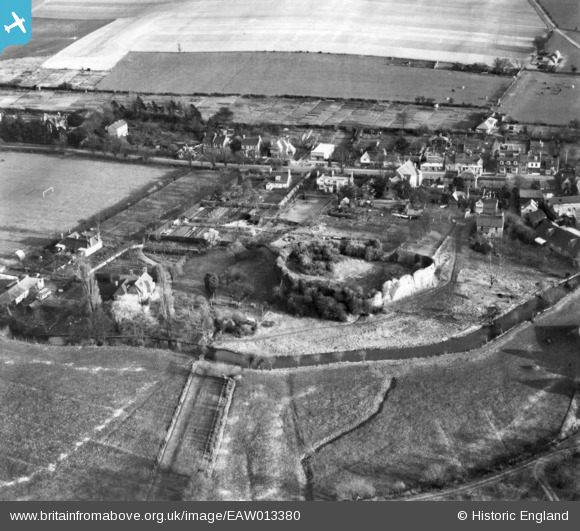
EAW013380 ENGLAND (1948). Eynsford Castle and environs, Eynsford, 1948. This image has been produced from a print.
© Copyright OpenStreetMap contributors and licensed by the OpenStreetMap Foundation. 2026. Cartography is licensed as CC BY-SA.
Nearby Images (22)
EAW013380

EAW034950

EAW034952

EAW034954

EAW013376

EAW013379

EAW034951

EAW034955

EAW013378

EAW013377

EAW029116

EAW029112

EAW029111

EAW029109

EAW029110

EAW029115

EAW023110

EAW029114

EAW029117

EAW013373

EAW013371

EAW013374

Details
| Title | [EAW013380] Eynsford Castle and environs, Eynsford, 1948. This image has been produced from a print. |
| Reference | EAW013380 |
| Date | 16-February-1948 |
| Link | |
| Place name | EYNSFORD |
| Parish | EYNSFORD |
| District | |
| Country | ENGLAND |
| Easting / Northing | 554189, 165834 |
| Longitude / Latitude | 0.21537862052369, 51.370104474253 |
| National Grid Reference | TQ542658 |
Pins
Be the first to add a comment to this image!