
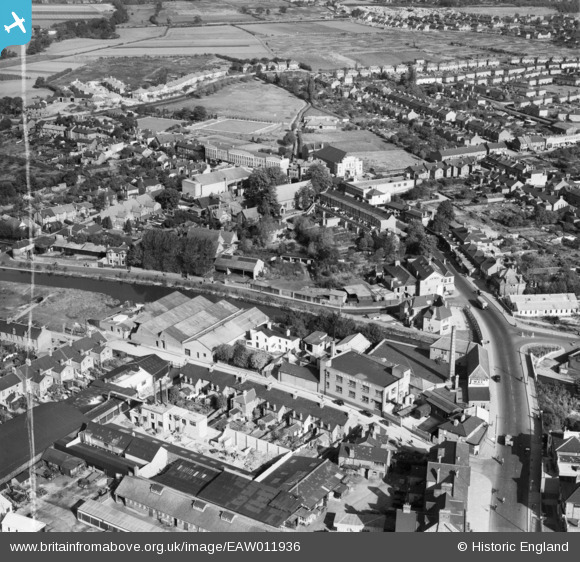
EAW011936 ENGLAND (1947). The S. C. Johnson and Son Works and the surrounding area, Yiewsley, 1947. This image was marked by Aerofilms Ltd for photo editing.
© Copyright OpenStreetMap contributors and licensed by the OpenStreetMap Foundation. 2026. Cartography is licensed as CC BY-SA.
Nearby Images (9)
EAW011936

EAW011940

EAW011942

EPW052762

EAW011941

EAW011938

EAW011935

EAW011937

EAW011939

Details
| Title | [EAW011936] The S. C. Johnson and Son Works and the surrounding area, Yiewsley, 1947. This image was marked by Aerofilms Ltd for photo editing. |
| Reference | EAW011936 |
| Date | 17-October-1947 |
| Link | |
| Place name | YIEWSLEY |
| Parish | |
| District | |
| Country | ENGLAND |
| Easting / Northing | 506022, 180363 |
| Longitude / Latitude | -0.47200560560841, 51.511751367394 |
| National Grid Reference | TQ060804 |
Pins

RobH |
Wednesday 11th of February 2026 09:57:03 AM | |
|
RobH |
Wednesday 11th of February 2026 09:56:08 AM | |

Matt Aldred edob.mattaldred.com |
Sunday 1st of August 2021 06:09:57 PM | |
|
Elcid |
Sunday 5th of March 2017 03:44:59 PM |