
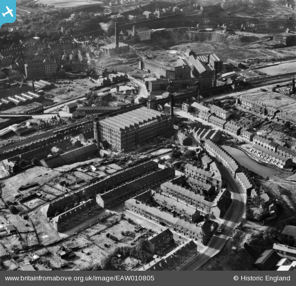
EAW010805 ENGLAND (1947). Brunswick Mill and environs, Mossley, 1947
© Copyright OpenStreetMap contributors and licensed by the OpenStreetMap Foundation. 2026. Cartography is licensed as CC BY-SA.
Nearby Images (10)
EAW010805

EAW010803

EAW010800

EAW010808

EAW010802

EAW010807

EAW010801

EAW010804

EAW010806

EPW016477

Details
| Title | [EAW010805] Brunswick Mill and environs, Mossley, 1947 |
| Reference | EAW010805 |
| Date | 17-September-1947 |
| Link | |
| Place name | MOSSLEY |
| Parish | MOSSLEY |
| District | |
| Country | ENGLAND |
| Easting / Northing | 397804, 401873 |
| Longitude / Latitude | -2.0331194846306, 53.513284634295 |
| National Grid Reference | SD978019 |
Pins

jams39 |
Monday 15th of November 2021 01:44:49 PM | |
|
stand easy |
Monday 8th of March 2021 08:08:47 PM | |
|
TheBlueCube |
Tuesday 28th of October 2014 09:00:11 PM | |
|
TheBlueCube |
Tuesday 28th of October 2014 08:58:46 PM | |
|
TheBlueCube |
Tuesday 28th of October 2014 08:57:44 PM |