
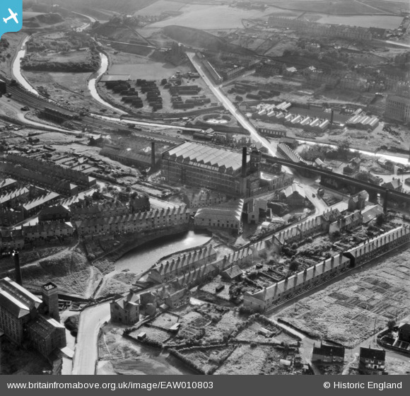
EAW010803 ENGLAND (1947). Brunswick Mill and environs, Mossley, 1947
© Copyright OpenStreetMap contributors and licensed by the OpenStreetMap Foundation. 2026. Cartography is licensed as CC BY-SA.
Nearby Images (10)
EAW010803

EAW010805

EAW010800

EAW010807

EAW010808

EAW010802

EAW010801

EAW010804

EAW010806

EPW016477

Details
| Title | [EAW010803] Brunswick Mill and environs, Mossley, 1947 |
| Reference | EAW010803 |
| Date | 17-September-1947 |
| Link | |
| Place name | MOSSLEY |
| Parish | MOSSLEY |
| District | |
| Country | ENGLAND |
| Easting / Northing | 397805, 401866 |
| Longitude / Latitude | -2.0331043538593, 53.513221712391 |
| National Grid Reference | SD978019 |
Pins

Alijh |
Friday 31st of January 2025 07:37:20 PM | |
|
Alijh |
Friday 31st of January 2025 07:36:57 PM | |
|
James |
Sunday 30th of April 2023 08:18:33 PM | |
|
James |
Sunday 30th of April 2023 08:17:22 PM | |
|
James |
Sunday 30th of April 2023 08:12:45 PM | |
|
James |
Sunday 30th of April 2023 08:11:49 PM |