
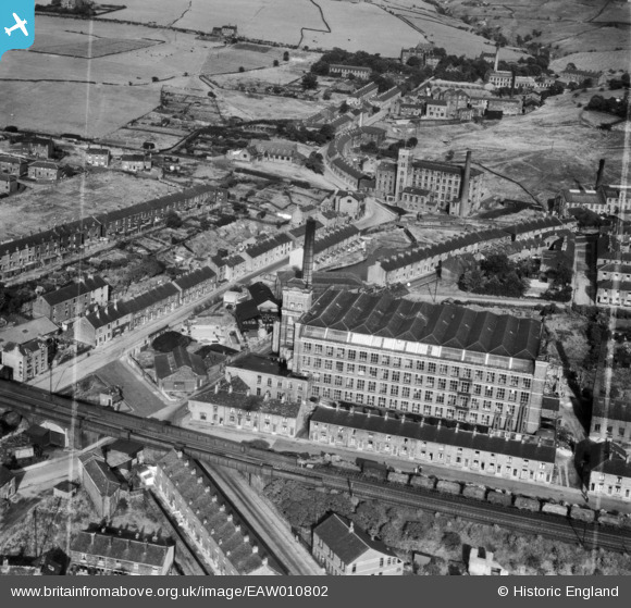
EAW010802 ENGLAND (1947). Brunswick Mill and environs, Mossley, 1947. This image was marked by Aerofilms Ltd for photo editing.
© Copyright OpenStreetMap contributors and licensed by the OpenStreetMap Foundation. 2026. Cartography is licensed as CC BY-SA.
Nearby Images (10)
EAW010802

EAW010808

EAW010801

EAW010806

EAW010805

EAW010803

EAW010804

EAW010807

EAW010800

EPW016477

Details
| Title | [EAW010802] Brunswick Mill and environs, Mossley, 1947. This image was marked by Aerofilms Ltd for photo editing. |
| Reference | EAW010802 |
| Date | 17-September-1947 |
| Link | |
| Place name | MOSSLEY |
| Parish | MOSSLEY |
| District | |
| Country | ENGLAND |
| Easting / Northing | 397794, 401902 |
| Longitude / Latitude | -2.0332705061206, 53.513545286179 |
| National Grid Reference | SD978019 |
Pins

Alijh |
Friday 31st of January 2025 07:39:17 PM |