
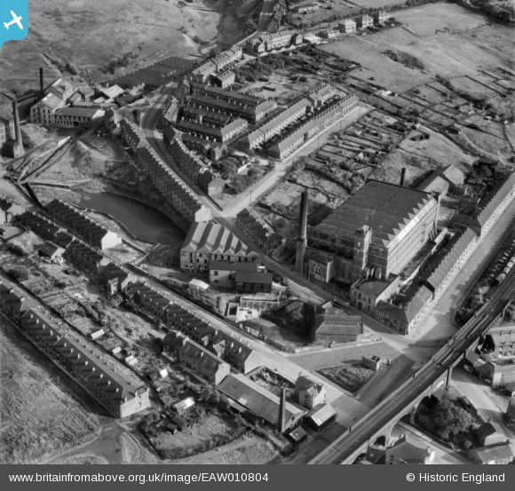
EAW010804 ENGLAND (1947). Brunswick Mill and environs, Mossley, 1947
© Copyright OpenStreetMap contributors and licensed by the OpenStreetMap Foundation. 2026. Cartography is licensed as CC BY-SA.
Nearby Images (10)
EAW010804

EAW010807

EAW010802

EAW010805

EAW010808

EAW010806

EAW010803

EAW010801

EAW010800

EPW016477

Details
| Title | [EAW010804] Brunswick Mill and environs, Mossley, 1947 |
| Reference | EAW010804 |
| Date | 17-September-1947 |
| Link | |
| Place name | MOSSLEY |
| Parish | MOSSLEY |
| District | |
| Country | ENGLAND |
| Easting / Northing | 397831, 401903 |
| Longitude / Latitude | -2.0327124856166, 53.5135544296 |
| National Grid Reference | SD978019 |
Pins

jams39 |
Friday 5th of November 2021 02:58:35 PM | |
|
jams39 |
Friday 5th of November 2021 02:58:20 PM | |
|
TheBlueCube |
Tuesday 28th of October 2014 08:55:40 PM | |
|
David Hall |
Saturday 9th of November 2013 04:39:10 PM |