
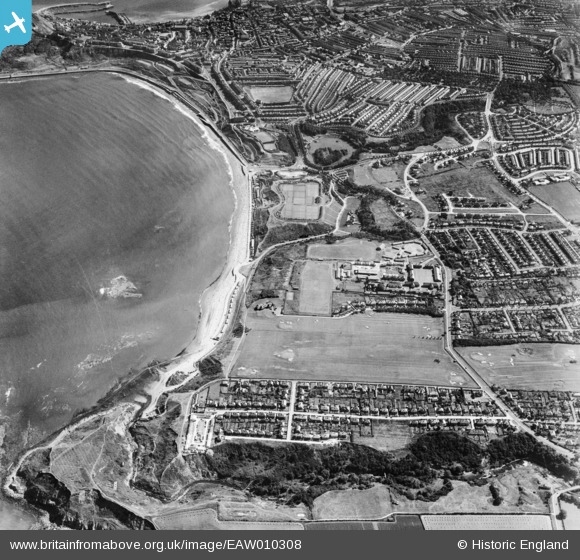
EAW010308 ENGLAND (1947). North Sands and the town, Scarborough, 1947
© Copyright OpenStreetMap contributors and licensed by the OpenStreetMap Foundation. 2026. Cartography is licensed as CC BY-SA.
Nearby Images (5)
EAW010308

EAW007961

EAW010302

EAW010301

EAW010307

Details
| Title | [EAW010308] North Sands and the town, Scarborough, 1947 |
| Reference | EAW010308 |
| Date | 25-August-1947 |
| Link | |
| Place name | SCARBOROUGH |
| Parish | |
| District | |
| Country | ENGLAND |
| Easting / Northing | 503476, 490273 |
| Longitude / Latitude | -0.40983425502136, 54.297421198375 |
| National Grid Reference | TA035903 |
Pins

fullwavebridge |
Thursday 23rd of January 2025 09:20:21 PM | |
|
fullwavebridge |
Monday 6th of November 2023 11:25:55 AM | |
|
redmist |
Friday 13th of September 2019 08:06:50 AM | |
|
redmist |
Thursday 12th of September 2019 09:07:51 AM | |
|
redmist |
Thursday 12th of September 2019 09:04:10 AM | |

Mullenaround |
Saturday 22nd of June 2019 02:49:25 PM | |
|
Mullenaround |
Saturday 22nd of June 2019 02:48:06 PM | |
|
Chris Kolonko |
Tuesday 12th of September 2017 10:11:59 PM | |
|
Chris Kolonko |
Tuesday 12th of September 2017 10:11:40 PM | |
|
MrsH |
Tuesday 8th of September 2015 11:07:22 PM |