
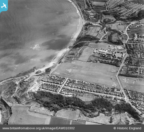
EAW010302 ENGLAND (1947). Scholes Park Road, North Sands and environs, Scarborough, 1947
© Copyright OpenStreetMap contributors and licensed by the OpenStreetMap Foundation. 2026. Cartography is licensed as CC BY-SA.
Nearby Images (5)
EAW010302

EAW010307

EAW010301

EAW010308

EAW010299

Details
| Title | [EAW010302] Scholes Park Road, North Sands and environs, Scarborough, 1947 |
| Reference | EAW010302 |
| Date | 25-August-1947 |
| Link | |
| Place name | SCARBOROUGH |
| Parish | |
| District | |
| Country | ENGLAND |
| Easting / Northing | 503402, 490488 |
| Longitude / Latitude | -0.41089656175712, 54.29936791434 |
| National Grid Reference | TA034905 |
Pins

Mart2164 |
Saturday 28th of August 2021 01:44:55 AM | |
|
Mart2164 |
Friday 27th of August 2021 08:22:25 PM | |
|
redmist |
Thursday 12th of September 2019 08:59:13 AM |