
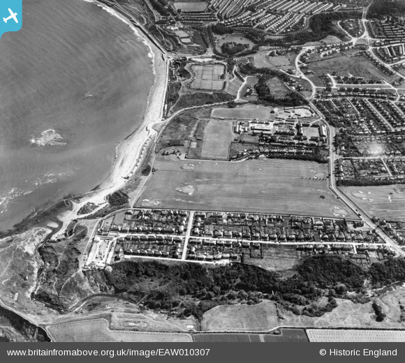
EAW010307 ENGLAND (1947). Scholes Park Road, North Sands and environs, Scarborough, 1947
© Copyright OpenStreetMap contributors and licensed by the OpenStreetMap Foundation. 2026. Cartography is licensed as CC BY-SA.
Nearby Images (4)
EAW010307

EAW010302

EAW010301

EAW010308

Details
| Title | [EAW010307] Scholes Park Road, North Sands and environs, Scarborough, 1947 |
| Reference | EAW010307 |
| Date | 25-August-1947 |
| Link | |
| Place name | SCARBOROUGH |
| Parish | |
| District | |
| Country | ENGLAND |
| Easting / Northing | 503352, 490486 |
| Longitude / Latitude | -0.4116653371192, 54.299360063133 |
| National Grid Reference | TA034905 |
Pins

The Laird |
Tuesday 19th of April 2022 12:00:54 AM | |
|
Mart2164 |
Tuesday 17th of August 2021 11:46:23 PM | |
|
The Laird |
Tuesday 2nd of June 2015 05:08:50 PM |