
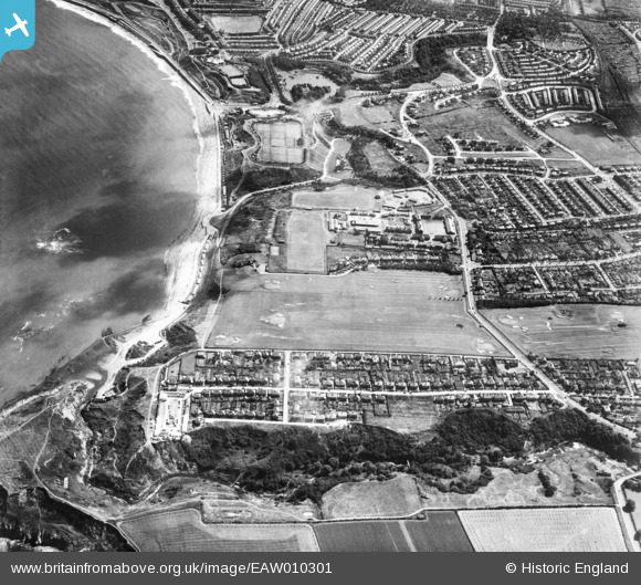
EAW010301 ENGLAND (1947). Scholes Park Road, North Sands and environs, Scarborough, 1947
© Copyright OpenStreetMap contributors and licensed by the OpenStreetMap Foundation. 2026. Cartography is licensed as CC BY-SA.
Nearby Images (4)
EAW010301

EAW010307

EAW010302

EAW010308

Details
| Title | [EAW010301] Scholes Park Road, North Sands and environs, Scarborough, 1947 |
| Reference | EAW010301 |
| Date | 25-August-1947 |
| Link | |
| Place name | SCARBOROUGH |
| Parish | |
| District | |
| Country | ENGLAND |
| Easting / Northing | 503318, 490438 |
| Longitude / Latitude | -0.41220423210499, 54.29893567006 |
| National Grid Reference | TA033904 |
Pins

The Laird |
Tuesday 2nd of June 2015 05:06:21 PM |