
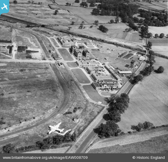
EAW008709 ENGLAND (1947). The Thornton Research Centre, Stanlow, 1947
© Copyright OpenStreetMap contributors and licensed by the OpenStreetMap Foundation. 2026. Cartography is licensed as CC BY-SA.
Nearby Images (7)
EAW008709

EAW008712

EAW008708

EAW008707

EAW008710

EAW008713

EAW008691

Details
| Title | [EAW008709] The Thornton Research Centre, Stanlow, 1947 |
| Reference | EAW008709 |
| Date | 1-August-1947 |
| Link | |
| Place name | STANLOW |
| Parish | |
| District | |
| Country | ENGLAND |
| Easting / Northing | 344901, 375668 |
| Longitude / Latitude | -2.8263652174013, 53.274853145691 |
| National Grid Reference | SJ449757 |
Pins

DonsideGeek |
Saturday 22nd of February 2014 12:00:05 AM | |
|
MB |
Saturday 16th of November 2013 04:20:23 PM | |
|
MB |
Saturday 16th of November 2013 04:19:22 PM | |
|
MB |
Saturday 16th of November 2013 04:18:33 PM | |
|
MB |
Saturday 16th of November 2013 04:17:32 PM | |
|
MB |
Saturday 16th of November 2013 04:17:02 PM |
User Comment Contributions
Remains of a Halifax bomber, with two of its four engines, and missing tail fins, assume used for electronic research. |
mcgeacs |
Sunday 10th of November 2013 08:08:58 PM |