
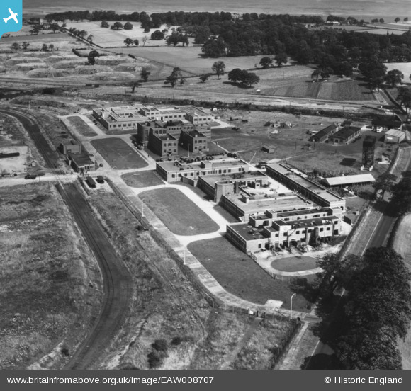
EAW008707 ENGLAND (1947). The Thornton Research Centre, Stanlow, 1947. This image has been produced from a print.
© Copyright OpenStreetMap contributors and licensed by the OpenStreetMap Foundation. 2026. Cartography is licensed as CC BY-SA.
Nearby Images (7)
EAW008707

EAW008712

EAW008709

EAW008708

EAW008710

EAW008713

EAW008691

Details
| Title | [EAW008707] The Thornton Research Centre, Stanlow, 1947. This image has been produced from a print. |
| Reference | EAW008707 |
| Date | 1-August-1947 |
| Link | |
| Place name | STANLOW |
| Parish | |
| District | |
| Country | ENGLAND |
| Easting / Northing | 344898, 375697 |
| Longitude / Latitude | -2.8264152337394, 53.275113511022 |
| National Grid Reference | SJ449757 |
Pins

Sparky |
Friday 13th of October 2017 09:34:31 AM | |
|
Sparky |
Friday 13th of October 2017 08:20:28 AM | |
|
Sparky |
Friday 13th of October 2017 08:15:47 AM |