
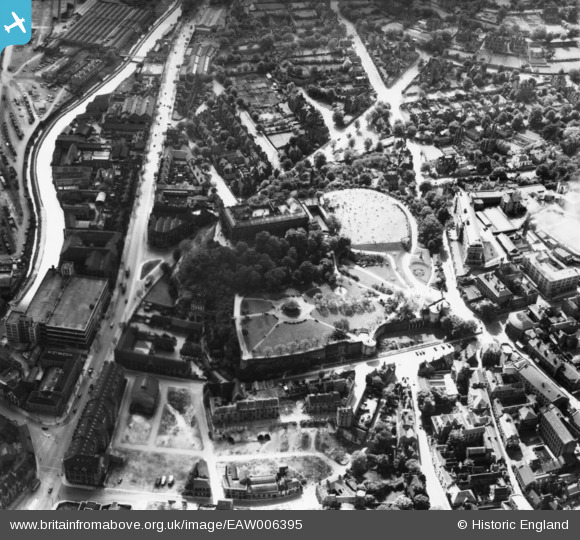
EAW006395 ENGLAND (1947). The castle and environs, Nottingham, 1947. This image has been produced from a print.
© Copyright OpenStreetMap contributors and licensed by the OpenStreetMap Foundation. 2026. Cartography is licensed as CC BY-SA.
Nearby Images (28)
EAW006395

EAW006400

EAW006396

EPW038629

EAW006399

EPW038632

EAW006397

EAW042518

EPW012557

EAW050485

EAW044654

EAW006401

EPW054987

EAW006398

EPW013012

EAW021701

EAW025937

EPW019376

EPW050652

EAW009531

EPW038048

EPW045368

EPW045370

EPW045366

EAW050484

EPW038049

EPW038046

EPW038047

Details
| Title | [EAW006395] The castle and environs, Nottingham, 1947. This image has been produced from a print. |
| Reference | EAW006395 |
| Date | 27-May-1947 |
| Link | |
| Place name | NOTTINGHAM |
| Parish | |
| District | |
| Country | ENGLAND |
| Easting / Northing | 456940, 339470 |
| Longitude / Latitude | -1.1524498238192, 52.949272783806 |
| National Grid Reference | SK569395 |
Pins
Be the first to add a comment to this image!