
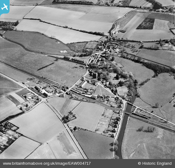
EAW004717 ENGLAND (1947). The village, Chartham, 1947
© Copyright OpenStreetMap contributors and licensed by the OpenStreetMap Foundation. 2026. Cartography is licensed as CC BY-SA.
Nearby Images (24)
EAW004717

EAW004716

EAW014332

EAW014333

EAW004715

EAW014326

EAW014328

EAW014329

EAW014325

EAW026256

EAW014331

EAW004718

EAW026261

EAW014330

EAW026258

EAW026264

EAW026260

EAW026262

EPW038133

EAW026257

EPW038132

EAW014327

EAW026263

EAW026259

Details
| Title | [EAW004717] The village, Chartham, 1947 |
| Reference | EAW004717 |
| Date | 26-April-1947 |
| Link | |
| Place name | CHARTHAM |
| Parish | CHARTHAM |
| District | |
| Country | ENGLAND |
| Easting / Northing | 610679, 155111 |
| Longitude / Latitude | 1.0196393549382, 51.255665661506 |
| National Grid Reference | TR107551 |
Pins
User Comment Contributions

AT pimples S0001105 |

Al |
Thursday 9th of January 2014 10:11:31 AM |