
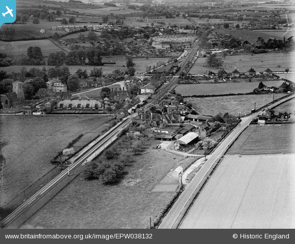
EPW038132 ENGLAND (1932). Burnthouse Farm and environs, Chartham, from the north-east, 1932
© Copyright OpenStreetMap contributors and licensed by the OpenStreetMap Foundation. 2026. Cartography is licensed as CC BY-SA.
Nearby Images (3)
EPW038132

EAW004717

EAW004716

Details
| Title | [EPW038132] Burnthouse Farm and environs, Chartham, from the north-east, 1932 |
| Reference | EPW038132 |
| Date | May-1932 |
| Link | |
| Place name | CHARTHAM |
| Parish | CHARTHAM |
| District | |
| Country | ENGLAND |
| Easting / Northing | 610758, 155297 |
| Longitude / Latitude | 1.02087953338, 51.257306816125 |
| National Grid Reference | TR108553 |
Pins
Be the first to add a comment to this image!