
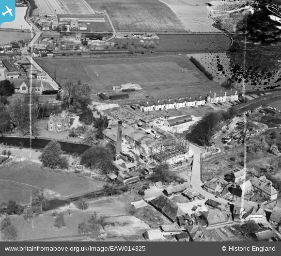
EAW014325 ENGLAND (1948). Chartham Paper Mill and environs, Chartham, 1948. This image was marked by Aerofilms Ltd for photo editing.
© Copyright OpenStreetMap contributors and licensed by the OpenStreetMap Foundation. 2026. Cartography is licensed as CC BY-SA.
Nearby Images (23)
EAW014325

EAW026256

EAW014329

EAW026262

EAW014328

EAW014331

EAW026257

EAW026258

EAW026260

EAW026261

EAW026259

EAW026263

EAW014332

EAW014333

EAW014326

EAW004715

EAW026264

EAW014330

EAW014327

EAW004718

EAW004716

EAW004717

EPW038131

Details
| Title | [EAW014325] Chartham Paper Mill and environs, Chartham, 1948. This image was marked by Aerofilms Ltd for photo editing. |
| Reference | EAW014325 |
| Date | 13-April-1948 |
| Link | |
| Place name | CHARTHAM |
| Parish | CHARTHAM |
| District | |
| Country | ENGLAND |
| Easting / Northing | 610806, 155005 |
| Longitude / Latitude | 1.0213944666815, 51.254666803749 |
| National Grid Reference | TR108550 |
Pins

John Wass |
Friday 17th of April 2015 09:24:53 PM |