
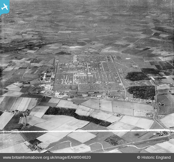
EAW004620 ENGLAND (1947). Former Royal Ordnance Factory Kirkby (Knowsley Industrial Park), Kirkby, 1947. This image was marked by Aerofilms Ltd for photo editing.
© Copyright OpenStreetMap contributors and licensed by the OpenStreetMap Foundation. 2026. Cartography is licensed as CC BY-SA.
Nearby Images (10)
EAW004620
, Kirkby, 1947. This image was marked by Aerofilms Ltd for photo editing.")
EAW004621
, Kirkby, 1947. This image was marked by Aerofilms Ltd for photo editing.")
EAW046990

EAW005659

EAW047000

EAW005658

EAW004617
, Kirkby, 1947")
EAW004616
, Kirkby, 1947")
EAW005660

EAW005657

Details
| Title | [EAW004620] Former Royal Ordnance Factory Kirkby (Knowsley Industrial Park), Kirkby, 1947. This image was marked by Aerofilms Ltd for photo editing. |
| Reference | EAW004620 |
| Date | 17-April-1947 |
| Link | |
| Place name | KIRKBY |
| Parish | |
| District | |
| Country | ENGLAND |
| Easting / Northing | 343193, 398594 |
| Longitude / Latitude | -2.8561015886576, 53.480746615059 |
| National Grid Reference | SJ432986 |
