
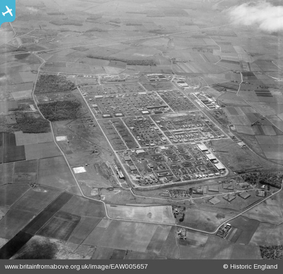
EAW005657 ENGLAND (1947). The site of Knowsley Industrial Estate and the surrounding countryside, Kirkby, 1947
© Copyright OpenStreetMap contributors and licensed by the OpenStreetMap Foundation. 2026. Cartography is licensed as CC BY-SA.
Nearby Images (5)
EAW005657

EAW004617
, Kirkby, 1947")
EAW005658

EAW004621
, Kirkby, 1947. This image was marked by Aerofilms Ltd for photo editing.")
EAW004620
, Kirkby, 1947. This image was marked by Aerofilms Ltd for photo editing.")
Details
| Title | [EAW005657] The site of Knowsley Industrial Estate and the surrounding countryside, Kirkby, 1947 |
| Reference | EAW005657 |
| Date | 15-May-1947 |
| Link | |
| Place name | KIRKBY |
| Parish | |
| District | |
| Country | ENGLAND |
| Easting / Northing | 343441, 398831 |
| Longitude / Latitude | -2.8524072983669, 53.482903599309 |
| National Grid Reference | SJ434988 |
Pins
Be the first to add a comment to this image!