
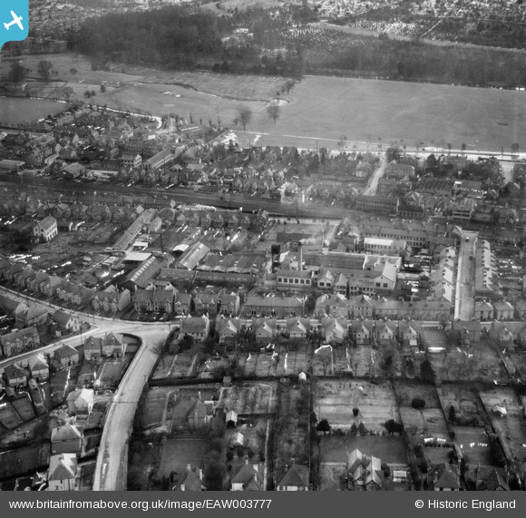
EAW003777 ENGLAND (1947). Long & Hambly Ltd Works and environs, High Wycombe, 1947
© Copyright OpenStreetMap contributors and licensed by the OpenStreetMap Foundation. 2026. Cartography is licensed as CC BY-SA.
Nearby Images (21)
EAW003777

EAW003768

EAW003772

EAW003773

EAW003774

EAW003775

EAW003770

EAW003776

EAW000988

EAW000983

EAW000986

EAW000982

EAW040088
 off Totteridge Road, High Wycombe, 1951. This image was marked by Aerofilms Ltd for photo editing.")
EAW040091
 off Totteridge Road, High Wycombe, 1951. This image was marked by Aerofilms Ltd for photo editing.")
EAW040089
 off Totteridge Road, High Wycombe, 1951. This image was marked by Aerofilms Ltd for photo editing.")
EAW040092
 off Totteridge Road, High Wycombe, 1951. This image was marked by Aerofilms Ltd for photo editing.")
EAW040090
 off Totteridge Road, High Wycombe, 1951. This image was marked by Aerofilms Ltd for photo editing.")
EAW040087
 off Totteridge Road, High Wycombe, 1951. This image was marked by Aerofilms Ltd for photo editing.")
EAW040085
 off Totteridge Road, High Wycombe, 1951")
EAW040086
 off Totteridge Road, High Wycombe, 1951. This image was marked by Aerofilms Ltd for photo editing.")
EAW003769

Details
| Title | [EAW003777] Long & Hambly Ltd Works and environs, High Wycombe, 1947 |
| Reference | EAW003777 |
| Date | 18-March-1947 |
| Link | |
| Place name | HIGH WYCOMBE |
| Parish | |
| District | |
| Country | ENGLAND |
| Easting / Northing | 487396, 192937 |
| Longitude / Latitude | -0.73723858806686, 51.627983424775 |
| National Grid Reference | SU874929 |
Pins
Be the first to add a comment to this image!