
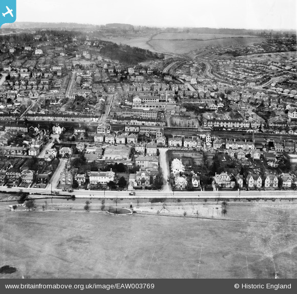
EAW003769 ENGLAND (1947). The Rye and the town around Wheeler's Field and environs, High Wycombe, from the south, 1947
© Copyright OpenStreetMap contributors and licensed by the OpenStreetMap Foundation. 2026. Cartography is licensed as CC BY-SA.
Nearby Images (4)
EAW003769

EAW003771

EAW003768

EAW003777

Details
| Title | [EAW003769] The Rye and the town around Wheeler's Field and environs, High Wycombe, from the south, 1947 |
| Reference | EAW003769 |
| Date | 18-March-1947 |
| Link | |
| Place name | HIGH WYCOMBE |
| Parish | |
| District | |
| Country | ENGLAND |
| Easting / Northing | 487259, 192689 |
| Longitude / Latitude | -0.7392793555172, 51.625775139891 |
| National Grid Reference | SU873927 |
Pins
Be the first to add a comment to this image!