
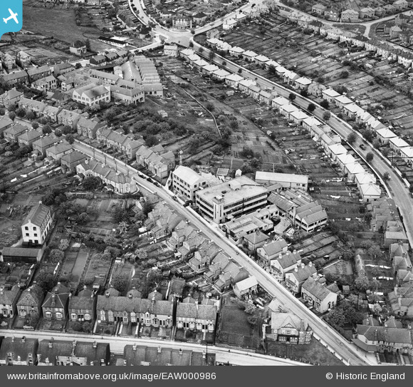
EAW000986 ENGLAND (1946). Bowerdean Road and Ernest Turner's Chiltern Works on Totteridge Avenue, High Wycombe, 1946
© Copyright OpenStreetMap contributors and licensed by the OpenStreetMap Foundation. 2026. Cartography is licensed as CC BY-SA.
Nearby Images (25)
EAW000986

EAW000982

EAW000988

EAW000983

EAW000984

EAW000985

EAW000987

EAW000989

EAW040089
 off Totteridge Road, High Wycombe, 1951. This image was marked by Aerofilms Ltd for photo editing.")
EAW040085
 off Totteridge Road, High Wycombe, 1951")
EAW040091
 off Totteridge Road, High Wycombe, 1951. This image was marked by Aerofilms Ltd for photo editing.")
EAW040092
 off Totteridge Road, High Wycombe, 1951. This image was marked by Aerofilms Ltd for photo editing.")
EAW040088
 off Totteridge Road, High Wycombe, 1951. This image was marked by Aerofilms Ltd for photo editing.")
EAW040090
 off Totteridge Road, High Wycombe, 1951. This image was marked by Aerofilms Ltd for photo editing.")
EAW040086
 off Totteridge Road, High Wycombe, 1951. This image was marked by Aerofilms Ltd for photo editing.")
EAW040087
 off Totteridge Road, High Wycombe, 1951. This image was marked by Aerofilms Ltd for photo editing.")
EAW003773

EAW003768

EAW003777

EAW003776

EAW003772

EAW003774

EAW003775

EPW038397

EAW023174

Details
| Title | [EAW000986] Bowerdean Road and Ernest Turner's Chiltern Works on Totteridge Avenue, High Wycombe, 1946 |
| Reference | EAW000986 |
| Date | 28-May-1946 |
| Link | |
| Place name | HIGH WYCOMBE |
| Parish | |
| District | |
| Country | ENGLAND |
| Easting / Northing | 487618, 192927 |
| Longitude / Latitude | -0.7340343143884, 51.62785898915 |
| National Grid Reference | SU876929 |
Pins
Be the first to add a comment to this image!