
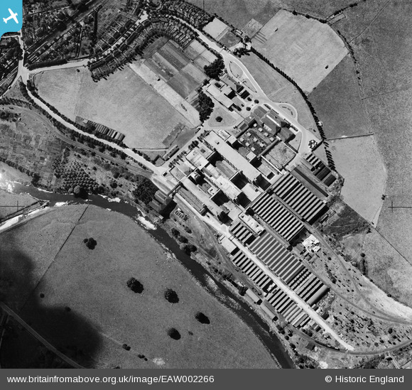
EAW002266 ENGLAND (1946). Fry's (Cadbury's) Somerdale Factory, Somerdale, 1946
© Copyright OpenStreetMap contributors and licensed by the OpenStreetMap Foundation. 2026. Cartography is licensed as CC BY-SA.
Nearby Images (9)
EAW002266
 Somerdale Factory, Somerdale, 1946")
EPW016949

EPW022274

EAW002267
 Somerdale Factory, Somerdale, 1946")
EPW038306

EAW002264
 Somerdale Factory, Somerdale, 1946")
EAW002268
 Somerdale Factory, Somerdale, 1946")
EAW002265
 Somerdale Factory, Somerdale, 1946")
EPW038305

Details
| Title | [EAW002266] Fry's (Cadbury's) Somerdale Factory, Somerdale, 1946 |
| Reference | EAW002266 |
| Date | 18-August-1946 |
| Link | |
| Place name | SOMERDALE |
| Parish | KEYNSHAM |
| District | |
| Country | ENGLAND |
| Easting / Northing | 365781, 169421 |
| Longitude / Latitude | -2.4921905569014, 51.422273515564 |
| National Grid Reference | ST658694 |

