
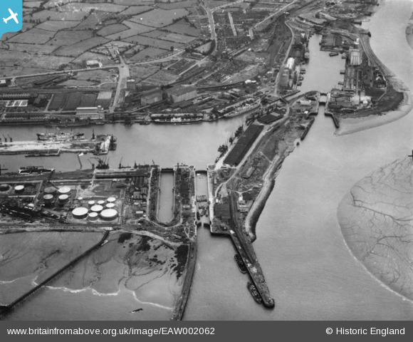
EAW002062 ENGLAND (1946). Avonmouth Docks, Avonmouth, 1946. This image has been produced from a print.
© Copyright OpenStreetMap contributors and licensed by the OpenStreetMap Foundation. 2026. Cartography is licensed as CC BY-SA.
Nearby Images (18)
EAW002062

EAW002073

EPW022378

EPW005502

EPW005504

EAW002058

EPW005492

EAW002056

EPW005508

EPW046968

EPW022377

EAW002057

EPW005506

EPW005493

EPW027952

EPW005500

EAW002061

EPR000075

Details
| Title | [EAW002062] Avonmouth Docks, Avonmouth, 1946. This image has been produced from a print. |
| Reference | EAW002062 |
| Date | 31-July-1946 |
| Link | |
| Place name | AVONMOUTH |
| Parish | |
| District | |
| Country | ENGLAND |
| Easting / Northing | 350823, 178635 |
| Longitude / Latitude | -2.7086067097465, 51.504023951529 |
| National Grid Reference | ST508786 |
Pins

redmist |
Tuesday 10th of November 2020 11:18:48 PM | |
|
redmist |
Tuesday 10th of November 2020 11:18:04 PM | |
|
redmist |
Tuesday 10th of November 2020 11:17:43 PM | |
|
redmist |
Tuesday 10th of November 2020 11:15:29 PM | |
|
redmist |
Tuesday 10th of November 2020 11:14:36 PM |