
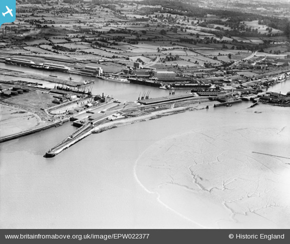
EPW022377 ENGLAND (1928). The Royal Edward Dock, Avonmouth, 1928
© Copyright OpenStreetMap contributors and licensed by the OpenStreetMap Foundation. 2026. Cartography is licensed as CC BY-SA.
Nearby Images (11)
EPW022377

EPW022378

EAW002073

EPW005506

EAW002057

EAW002062

EPW005523

EPW005504

EAW002058

EPW005508

EPW005492

Details
| Title | [EPW022377] The Royal Edward Dock, Avonmouth, 1928 |
| Reference | EPW022377 |
| Date | 21-July-1928 |
| Link | |
| Place name | AVONMOUTH |
| Parish | |
| District | |
| Country | ENGLAND |
| Easting / Northing | 350652, 178575 |
| Longitude / Latitude | -2.7110621010817, 51.503469533267 |
| National Grid Reference | ST507786 |
Pins

Class31 |
Saturday 22nd of February 2014 08:01:28 PM |