
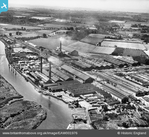
EAW001976 ENGLAND (1946). Aylesford Paper Mills, Ditton, 1946
© Copyright OpenStreetMap contributors and licensed by the OpenStreetMap Foundation. 2026. Cartography is licensed as CC BY-SA.
Nearby Images (17)
EAW001976

EAW001973

EAW018288

EAW001975

EAW018287

EAW001979

EPW045997

EPW045998

EPW046000

EPW045999

EAW001980

EAW018286

EPW047728

EAW001977

EPW047727

EPW046001

EAW001974

Details
| Title | [EAW001976] Aylesford Paper Mills, Ditton, 1946 |
| Reference | EAW001976 |
| Date | 25-July-1946 |
| Link | |
| Place name | DITTON |
| Parish | DITTON |
| District | |
| Country | ENGLAND |
| Easting / Northing | 571317, 159638 |
| Longitude / Latitude | 0.45825999377259, 51.309527643885 |
| National Grid Reference | TQ713596 |
Pins

David |
Friday 24th of May 2019 05:14:59 PM |