
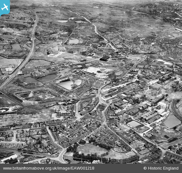
EAW001218 ENGLAND (1946). The Albright and Wilson Chemical Works and the surrounding industrial and residential area, Oldbury, 1946
© Copyright OpenStreetMap contributors and licensed by the OpenStreetMap Foundation. 2026. Cartography is licensed as CC BY-SA.
Nearby Images (6)
EAW001218

EAW001213

EAW001212

EAW001217

EPW010564

EPW061253

Details
| Title | [EAW001218] The Albright and Wilson Chemical Works and the surrounding industrial and residential area, Oldbury, 1946 |
| Reference | EAW001218 |
| Date | 24-June-1946 |
| Link | |
| Place name | OLDBURY |
| Parish | |
| District | |
| Country | ENGLAND |
| Easting / Northing | 398974, 288603 |
| Longitude / Latitude | -2.0151139534467, 52.494966956936 |
| National Grid Reference | SO990886 |
Pins

Sparky |
Sunday 24th of September 2017 12:39:58 PM | |

John W |
Thursday 21st of July 2016 05:52:33 PM | |
|
John W |
Thursday 21st of July 2016 05:51:44 PM | |
|
Martin |
Saturday 21st of November 2015 09:56:14 PM | |
|
Martin |
Saturday 21st of November 2015 09:53:16 PM | |
|
artscotak2 |
Monday 10th of February 2014 02:43:57 PM | |
|
artscotak2 |
Monday 10th of February 2014 02:42:49 PM | |
|
artscotak2 |
Monday 10th of February 2014 02:40:08 PM | |
|
artscotak2 |
Monday 10th of February 2014 02:38:36 PM | |
|
Martin |
Wednesday 29th of January 2014 12:04:38 AM |