
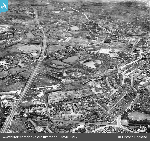
EAW001217 ENGLAND (1946). The junction of Wolverhampton Road and Birchfield Lane, Jarvis Crescent and the surrounding industrial area, Oldbury, 1946
© Copyright OpenStreetMap contributors and licensed by the OpenStreetMap Foundation. 2026. Cartography is licensed as CC BY-SA.
Nearby Images (6)
EAW001217

EAW001213

EAW001211

EAW001218

EAW001214

EAW001212

Details
| Title | [EAW001217] The junction of Wolverhampton Road and Birchfield Lane, Jarvis Crescent and the surrounding industrial area, Oldbury, 1946 |
| Reference | EAW001217 |
| Date | 24-June-1946 |
| Link | |
| Place name | OLDBURY |
| Parish | |
| District | |
| Country | ENGLAND |
| Easting / Northing | 398827, 288419 |
| Longitude / Latitude | -2.0172787543752, 52.493312319176 |
| National Grid Reference | SO988884 |
Pins

Matt Aldred edob.mattaldred.com |
Sunday 5th of April 2026 01:24:15 PM | |

Mr |
Thursday 15th of August 2019 02:07:24 PM | |
|
Mr |
Thursday 15th of August 2019 02:06:56 PM | |
|
Keith Millinson |
Monday 9th of January 2017 07:58:43 PM | |
|
Keith Millinson |
Monday 9th of January 2017 07:56:46 PM | |
|
Keith Millinson |
Monday 9th of January 2017 07:54:54 PM | |
|
Keith Millinson |
Monday 9th of January 2017 07:54:01 PM | |
|
Keith Millinson |
Monday 9th of January 2017 07:53:12 PM | |
|
Keith Millinson |
Monday 9th of January 2017 07:52:35 PM | |
|
Keith Millinson |
Monday 9th of January 2017 07:51:05 PM | |
|
MikeS |
Sunday 17th of August 2014 12:54:55 PM | |
|
Martin |
Wednesday 29th of January 2014 11:45:41 PM | |
|
Martin |
Wednesday 29th of January 2014 11:43:34 PM | |
|
Martin |
Wednesday 29th of January 2014 11:42:48 PM | |
|
Martin |
Wednesday 29th of January 2014 11:41:59 PM | |
|
Martin |
Wednesday 29th of January 2014 11:40:58 PM |