
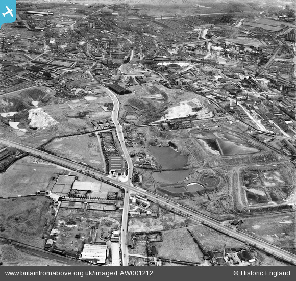
EAW001212 ENGLAND (1946). The junction of Wolverhampton Road and Birchfield Lane and the surrounding industrial area, Oldbury, 1946
© Copyright OpenStreetMap contributors and licensed by the OpenStreetMap Foundation. 2026. Cartography is licensed as CC BY-SA.
Nearby Images (7)
EAW001212

EAW001211

EAW001214

EAW001218

EAW001217

EAW001213

EAW001219

Details
| Title | [EAW001212] The junction of Wolverhampton Road and Birchfield Lane and the surrounding industrial area, Oldbury, 1946 |
| Reference | EAW001212 |
| Date | 24-June-1946 |
| Link | |
| Place name | OLDBURY |
| Parish | |
| District | |
| Country | ENGLAND |
| Easting / Northing | 398757, 288667 |
| Longitude / Latitude | -2.0183108081899, 52.495541928451 |
| National Grid Reference | SO988887 |
Pins

redmist |
Monday 10th of October 2022 09:16:24 PM | |
|
redmist |
Monday 10th of October 2022 09:15:41 PM | |
|
Mark P |
Tuesday 21st of July 2020 08:04:52 PM | |

Sparky |
Thursday 16th of November 2017 09:59:27 PM | |
|
Sparky |
Thursday 16th of November 2017 09:58:57 PM | |
|
John W |
Thursday 21st of July 2016 06:05:13 PM | |
|
mark48 |
Friday 8th of April 2016 09:44:59 PM | |
|
mark48 |
Friday 8th of April 2016 09:43:10 PM | |
|
Martin |
Saturday 28th of December 2013 09:27:38 PM |