
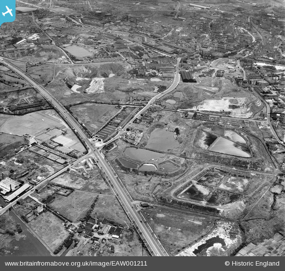
EAW001211 ENGLAND (1946). The junction of Wolverhampton Road and Birchfield Lane and the Radnor Field Brick Works, Oldbury, 1946
© Copyright OpenStreetMap contributors and licensed by the OpenStreetMap Foundation. 2026. Cartography is licensed as CC BY-SA.
Nearby Images (5)
EAW001211

EAW001214

EAW001212

EAW001217

EAW001213

Details
| Title | [EAW001211] The junction of Wolverhampton Road and Birchfield Lane and the Radnor Field Brick Works, Oldbury, 1946 |
| Reference | EAW001211 |
| Date | 24-June-1946 |
| Link | |
| Place name | OLDBURY |
| Parish | |
| District | |
| Country | ENGLAND |
| Easting / Northing | 398686, 288551 |
| Longitude / Latitude | -2.0193562611701, 52.494498807814 |
| National Grid Reference | SO987886 |
Pins

John W |
Thursday 21st of July 2016 05:48:51 PM | |
|
John W |
Thursday 21st of July 2016 05:47:39 PM | |
|
DaveT |
Sunday 17th of November 2013 04:46:06 PM |