
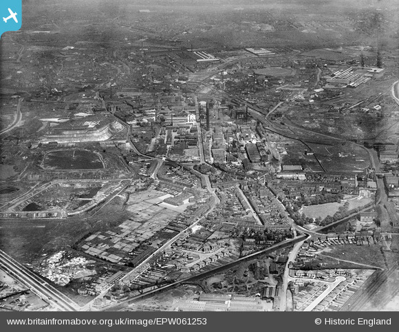
EPW061253 ENGLAND (1939). The Albright and Wilson Chemical Works and the surrounding area, Langley, 1939
© Copyright OpenStreetMap contributors and licensed by the OpenStreetMap Foundation. 2026. Cartography is licensed as CC BY-SA.
Nearby Images (2)
EPW061253

EAW001218

Details
| Title | [EPW061253] The Albright and Wilson Chemical Works and the surrounding area, Langley, 1939 |
| Reference | EPW061253 |
| Date | 31-May-1939 |
| Link | |
| Place name | LANGLEY |
| Parish | |
| District | |
| Country | ENGLAND |
| Easting / Northing | 399179, 288430 |
| Longitude / Latitude | -2.0120936823068, 52.493411863558 |
| National Grid Reference | SO992884 |
Pins

John W |
Thursday 21st of July 2016 05:28:16 PM | |
|
John W |
Thursday 21st of July 2016 05:24:43 PM | |
|
kefizz |
Friday 6th of June 2014 11:52:04 PM | |
|
artscotak2 |
Monday 10th of February 2014 02:50:36 PM |