
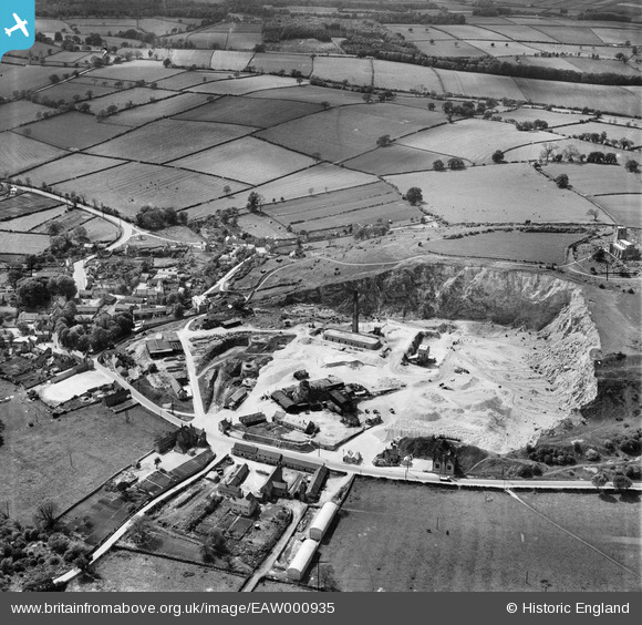
EAW000935 ENGLAND (1946). The Breedon Lime Works and environs, Breedon on the Hill, 1946
© Copyright OpenStreetMap contributors and licensed by the OpenStreetMap Foundation. 2026. Cartography is licensed as CC BY-SA.
Nearby Images (18)
EAW000935

EPW062141

EPW062142

EAW000929

EAW000941

EAW001701

EAW001700

EPW062140

EAW001699

EAW000942

EPW062139

EPW062143

EAW000943

EAW000940

EAW001668

EAW001697

EPW062144

EAW001698

Details
| Title | [EAW000935] The Breedon Lime Works and environs, Breedon on the Hill, 1946 |
| Reference | EAW000935 |
| Date | 29-May-1946 |
| Link | |
| Place name | BREEDON ON THE HILL |
| Parish | BREEDON ON THE HILL |
| District | |
| Country | ENGLAND |
| Easting / Northing | 440580, 323070 |
| Longitude / Latitude | -1.3979952813685, 52.803325306339 |
| National Grid Reference | SK406231 |
Pins

MB |
Saturday 31st of August 2013 05:14:49 PM | |
|
MB |
Saturday 31st of August 2013 05:14:13 PM | |
|
MB |
Saturday 31st of August 2013 05:13:26 PM | |
|
MB |
Saturday 31st of August 2013 05:12:06 PM | |
|
MB |
Saturday 31st of August 2013 05:11:04 PM | |
|
MB |
Saturday 31st of August 2013 05:09:53 PM | |
|
MB |
Saturday 31st of August 2013 05:08:57 PM | |
|
MB |
Saturday 31st of August 2013 05:07:46 PM | |
|
MB |
Saturday 31st of August 2013 05:07:14 PM | |
|
MB |
Saturday 31st of August 2013 05:06:38 PM | |
|
MB |
Saturday 31st of August 2013 05:06:09 PM |