
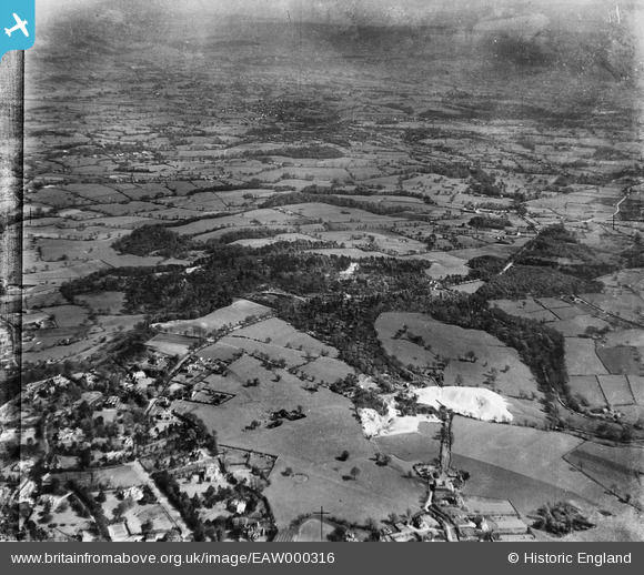
EAW000316 ENGLAND (1946). Woodland on either side of the Macclesfield Road and surrounding countryside, Alderley Edge, from the west, 1946
© Copyright OpenStreetMap contributors and licensed by the OpenStreetMap Foundation. 2026. Cartography is licensed as CC BY-SA.
Nearby Images (8)
EAW000316

EAW000448

EAW000317

EAW000319

EAW000320

EAW000315

EAW000318

EAW000446

Details
| Title | [EAW000316] Woodland on either side of the Macclesfield Road and surrounding countryside, Alderley Edge, from the west, 1946 |
| Reference | EAW000316 |
| Date | 19-April-1946 |
| Link | |
| Place name | ALDERLEY EDGE |
| Parish | NETHER ALDERLEY |
| District | |
| Country | ENGLAND |
| Easting / Northing | 385444, 377637 |
| Longitude / Latitude | -2.2184101710385, 53.295217174342 |
| National Grid Reference | SJ854776 |
Pins

jonnyhud |
Tuesday 22nd of December 2015 12:43:24 PM |