
Scheduled Maintenance
This website will undergo scheduled maintenance on Tuesday, September 10th, between 11:00 and 15:00, as well as on Thursday, September 12th, between 10:00 and 12:00. During this time, services may be temporarily disrupted. We apologise for any inconvenience.
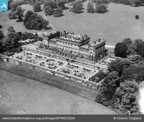
epw015834 ENGLAND (1926). Harewood House, Harewood, 1926
© Copyright OpenStreetMap contributors and licensed by the OpenStreetMap Foundation. 2024. Cartography is licensed as CC BY-SA.
Nearby Images (7)
EPW015834

EPW015833

EPW015836

EPW015832

EPW015835

EAW025640

EAW025638

Details
| Title | [EPW015834] Harewood House, Harewood, 1926 |
| Reference | EPW015834 |
| Date | 5-June-1926 |
| Link | |
| Place name | HAREWOOD |
| Parish | HAREWOOD |
| District | |
| Country | ENGLAND |
| Easting / Northing | 431176, 444614 |
| Longitude / Latitude | -1.5255182747914, 53.896557057931 |
| National Grid Reference | SE312446 |
Pins
Be the first to add a comment to this image!