
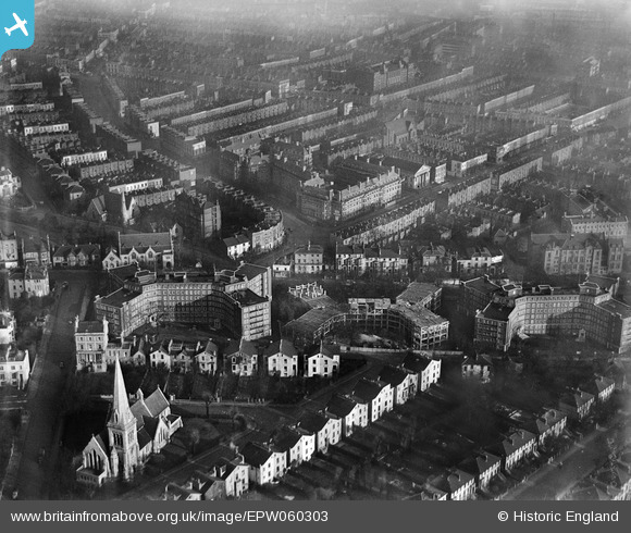
EPW060303 ENGLAND (1938). Blocks of flats on Eton College Road (Eton Rise, Eton Hall and Eton Place), Maitland Park, 1938
© Copyright OpenStreetMap contributors and licensed by the OpenStreetMap Foundation. 2024. Cartography is licensed as CC BY-SA.
Nearby Images (31)
EPW060303
, Maitland Park, 1938")
EPW058475

EPW060304
, Maitland Park, 1938")
EPW060302
, Maitland Park, 1938")
EPW058476

EPW058478

EPW058473

EPW060332

EPW058474

EPW060305
, Maitland Park, 1938")
EPW060306
, Maitland Park, 1938")
EPW058477

EPW058593

EPW058594

EPW060331

EPW058592

EPW058591

EPW060333

EPW060335

EPW056360

EPW056362

EPW060330

EPW056361

EPW056364

EPW060334

EPW058590

EPW056358

EPW056363

EPW056365

EPW056359

EPW000808

Details
| Title | [EPW060303] Blocks of flats on Eton College Road (Eton Rise, Eton Hall and Eton Place), Maitland Park, 1938 |
| Reference | EPW060303 |
| Date | 30-December-1938 |
| Link | |
| Place name | MAITLAND PARK |
| Parish | |
| District | |
| Country | ENGLAND |
| Easting / Northing | 528006, 184578 |
| Longitude / Latitude | -0.15380059587114, 51.54508141746 |
| National Grid Reference | TQ280846 |
Pins
 Class31 |
Tuesday 15th of October 2013 08:33:56 PM | |
Class31 |
Tuesday 15th of October 2013 09:50:41 AM | |
Class31 |
Tuesday 15th of October 2013 09:50:20 AM | |
Class31 |
Tuesday 15th of October 2013 09:50:01 AM | |
Class31 |
Tuesday 15th of October 2013 09:49:42 AM | |
Class31 |
Tuesday 15th of October 2013 09:48:56 AM | |
Class31 |
Tuesday 15th of October 2013 09:48:36 AM |


