
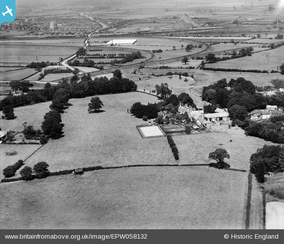
EPW058132 ENGLAND (1938). Wellow House and surrounding countryside, Wellow, from the south, 1938
© Copyright OpenStreetMap contributors and licensed by the OpenStreetMap Foundation. 2024. Cartography is licensed as CC BY-SA.
Nearby Images (14)
EPW058132

EPW058134

EPW058133

EPW058136

EPW058138

EPW058139

EPW058137

EPW058135

EPW058140

EPW058144

EPW058141

EPW058142

EPW058143

EPW058145

Details
| Title | [EPW058132] Wellow House and surrounding countryside, Wellow, from the south, 1938 |
| Reference | EPW058132 |
| Date | 19-July-1938 |
| Link | |
| Place name | WELLOW |
| Parish | WELLOW |
| District | |
| Country | ENGLAND |
| Easting / Northing | 466757, 366093 |
| Longitude / Latitude | -1.0008227043747, 53.18744866689 |
| National Grid Reference | SK668661 |
Pins
 Sydney Carr |
Sunday 5th of July 2020 10:28:22 AM | |
totoro |
Thursday 11th of May 2017 10:30:35 PM | |
totoro |
Thursday 11th of May 2017 10:29:35 PM | |
totoro |
Thursday 11th of May 2017 10:27:26 PM | |
Actually the railway inking the main Shirebrook to Lincoln line, which was withdrawn in !966, with the colliery at Bilsthorpe . |
Sydney Carr |
Sunday 5th of July 2020 10:25:33 AM |
totoro |
Thursday 11th of May 2017 10:26:19 PM | |
totoro |
Thursday 11th of May 2017 10:24:59 PM | |
totoro |
Thursday 11th of May 2017 10:05:05 PM |


