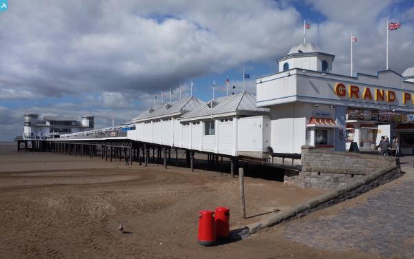
EPW048443 ENGLAND (1935). The Grand Pier, Weston Bay and the town, Weston-Super-Mare, from the south-east, 1935

© Copyright OpenStreetMap contributors and licensed by the OpenStreetMap Foundation. 2024. Cartography is licensed as CC BY-SA.
Nearby Images (24)
EPW048443

EPW051716

EPW039932

EAW025155

EPW023970

EPW023960

EPW001039

EAW015057

EPW048457

EPW039936

EAW056067

EAW015058

EAW016134

EAW015056

EPW039934

EPW048445

EAW016133

EPW048456

EPW023957

EPW023967

EPW024071

EPW023966

EPW033286

EPW048449

Details
| Title | [EPW048443] The Grand Pier, Weston Bay and the town, Weston-Super-Mare, from the south-east, 1935 |
| Reference | EPW048443 |
| Date | July-1935 |
| Link | |
| Place name | WESTON-SUPER-MARE |
| Parish | WESTON-SUPER-MARE |
| District | |
| Country | ENGLAND |
| Easting / Northing | 331675, 161317 |
| Longitude / Latitude | -2.9811381794504, 51.346321598782 |
| National Grid Reference | ST317613 |
Pins
 Alan McFaden |
Saturday 19th of October 2013 01:23:12 PM | |
Alan McFaden |
Saturday 19th of October 2013 01:21:56 PM | |
Alan McFaden |
Saturday 19th of October 2013 01:18:07 PM | |
Alan McFaden |
Saturday 19th of October 2013 01:16:56 PM | |
Alan McFaden |
Saturday 19th of October 2013 01:16:02 PM | |
Alan McFaden |
Saturday 19th of October 2013 01:15:22 PM |