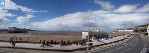
EAW016133 ENGLAND (1948). Grand Pier and the seafront, Weston-Super-Mare, from the south-east, 1948. This image has been produced from a damaged negative.
© Copyright OpenStreetMap contributors and licensed by the OpenStreetMap Foundation. 2024. Cartography is licensed as CC BY-SA.
Nearby Images (25)
Details
| Title | [EAW016133] Grand Pier and the seafront, Weston-Super-Mare, from the south-east, 1948. This image has been produced from a damaged negative. |
| Reference | EAW016133 |
| Date | 21-May-1948 |
| Link | |
| Place name | WESTON-SUPER-MARE |
| Parish | WESTON-SUPER-MARE |
| District | |
| Country | ENGLAND |
| Easting / Northing | 331576, 161481 |
| Longitude / Latitude | -2.982591120642, 51.34778427781 |
| National Grid Reference | ST316615 |
Pins
 Alan McFaden |
Friday 31st of October 2014 09:40:06 AM | |
 Alan McFaden |
Friday 31st of October 2014 09:39:37 AM |
User Comment Contributions
 Weston-Super-Mare Grove Park |
 Alan McFaden |
Friday 31st of October 2014 09:41:47 AM |
 Weston-Super-Mare Italianate Gardens |
 Alan McFaden |
Friday 31st of October 2014 09:41:05 AM |


![[EAW016133] Grand Pier and the seafront, Weston-Super-Mare, from the south-east, 1948. This image has been produced from a damaged negative.](http://britainfromabove.org.uk/sites/all/libraries/aerofilms-images/public/100x100/EAW/016/EAW016133.jpg)
![[EPW039934] The Grand Pier and the beach, Weston-super-Mare, from the south-east, 1932](http://britainfromabove.org.uk/sites/all/libraries/aerofilms-images/public/100x100/EPW/039/EPW039934.jpg)
![[EPW001039] View over Weston-Super-Mare and the Grand Pier, Weston-Super-Mare, from the south-west, 1920](http://britainfromabove.org.uk/sites/all/libraries/aerofilms-images/public/100x100/EPW/001/EPW001039.jpg)
![[EAW016134] Grand Pier and the seafront, Weston-Super-Mare, from the south, 1948. This image has been produced from a damaged negative.](http://britainfromabove.org.uk/sites/all/libraries/aerofilms-images/public/100x100/EAW/016/EAW016134.jpg)
![[EPW023967] The Grand Pier Pavilion, Weston-Super-Mare, 1928](http://britainfromabove.org.uk/sites/all/libraries/aerofilms-images/public/100x100/EPW/023/EPW023967.jpg)
![[EAW015056] Marine Parade and the town, Weston-super-Mare, 1948. This image has been produced from a damaged negative.](http://britainfromabove.org.uk/sites/all/libraries/aerofilms-images/public/100x100/EAW/015/EAW015056.jpg)
![[EAW025155] Crowds on the beach near the entrance to the Grand Pier, Weston-super-Mare, 1949](http://britainfromabove.org.uk/sites/all/libraries/aerofilms-images/public/100x100/EAW/025/EAW025155.jpg)
![[EPW023966] The Grand Pier, Weston-Super-Mare, 1928](http://britainfromabove.org.uk/sites/all/libraries/aerofilms-images/public/100x100/EPW/023/EPW023966.jpg)
![[EPW023969] The Royal Parade, Winter Gardens and Model Yacht Pond, Weston-Super-Mare, 1928](http://britainfromabove.org.uk/sites/all/libraries/aerofilms-images/public/100x100/EPW/023/EPW023969.jpg)
![[EPW033286] The fire damaged Grand Pier, Weston-Super-Mare, 1930](http://britainfromabove.org.uk/sites/all/libraries/aerofilms-images/public/100x100/EPW/033/EPW033286.jpg)
![[EPW024071] The Grand Pier, Weston-super-Mare, 1928](http://britainfromabove.org.uk/sites/all/libraries/aerofilms-images/public/100x100/EPW/024/EPW024071.jpg)
![[EAW015057] Marine Parade and the town, Weston-super-Mare, from the south-west, 1948. This image has been produced from a damaged negative.](http://britainfromabove.org.uk/sites/all/libraries/aerofilms-images/public/100x100/EAW/015/EAW015057.jpg)
![[EPW051716] Marine Parade by the Grand Pier and the town, Weston-super-Mare, from the south-west, 1936. This image has been produced from a copy-negative.](http://britainfromabove.org.uk/sites/all/libraries/aerofilms-images/public/100x100/EPW/051/EPW051716.jpg)
![[EPW023970] The pier entrance, Weston-Super-Mare, 1928](http://britainfromabove.org.uk/sites/all/libraries/aerofilms-images/public/100x100/EPW/023/EPW023970.jpg)
![[EPW023960] The Royal Parade, Weston-Super-Mare, 1928](http://britainfromabove.org.uk/sites/all/libraries/aerofilms-images/public/100x100/EPW/023/EPW023960.jpg)
![[EPW051708] The Winter Gardens Pavilion, Weston-super-Mare, 1936. This image has been produced from a copy-negative.](http://britainfromabove.org.uk/sites/all/libraries/aerofilms-images/public/100x100/EPW/051/EPW051708.jpg)
![[EPW048452] The Grand Pier and the town, Weston-Super-Mare, from the south-west, 1935](http://britainfromabove.org.uk/sites/all/libraries/aerofilms-images/public/100x100/EPW/048/EPW048452.jpg)
![[EPW024072] The Model Yacht Pond, Weston-super-Mare, 1928](http://britainfromabove.org.uk/sites/all/libraries/aerofilms-images/public/100x100/EPW/024/EPW024072.jpg)
![[EPW048443] The Grand Pier, Weston Bay and the town, Weston-Super-Mare, from the south-east, 1935](http://britainfromabove.org.uk/sites/all/libraries/aerofilms-images/public/100x100/EPW/048/EPW048443.jpg)
![[EPW039932] Marine Parade, Weston-super-Mare, 1932](http://britainfromabove.org.uk/sites/all/libraries/aerofilms-images/public/100x100/EPW/039/EPW039932.jpg)
![[EPW048451] The Grand Pier and the town, Weston-Super-Mare, from the south-west, 1935](http://britainfromabove.org.uk/sites/all/libraries/aerofilms-images/public/100x100/EPW/048/EPW048451.jpg)
![[EPW048453] The Grand Pier and the town, Weston-Super-Mare, from the south-west, 1935](http://britainfromabove.org.uk/sites/all/libraries/aerofilms-images/public/100x100/EPW/048/EPW048453.jpg)
![[EPW048457] The Grand Pier and the town, Weston-Super-Mare, from the south, 1935](http://britainfromabove.org.uk/sites/all/libraries/aerofilms-images/public/100x100/EPW/048/EPW048457.jpg)
![[EAW015053] The Grand Pier and environs, Weston-super-Mare, from the south, 1948. This image has been produced from a damaged negative.](http://britainfromabove.org.uk/sites/all/libraries/aerofilms-images/public/100x100/EAW/015/EAW015053.jpg)
![[EPW039936] Marine Parade, Beach Road and environs, Weston-super-Mare, 1932](http://britainfromabove.org.uk/sites/all/libraries/aerofilms-images/public/100x100/EPW/039/EPW039936.jpg)


