
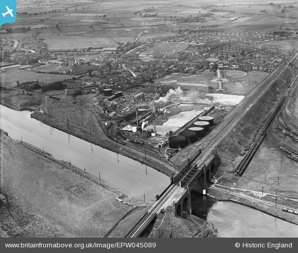
EPW045089 ENGLAND (1934). British Tar Products Ltd and the Manchester Ship Canal, Cadishead, from the east, 1934
© Copyright OpenStreetMap contributors and licensed by the OpenStreetMap Foundation. 2024. Cartography is licensed as CC BY-SA.
Nearby Images (6)
EPW045089

EPW045090

EPW045088

EPW045091

EPW045086

EPW045087

Details
| Title | [EPW045089] British Tar Products Ltd and the Manchester Ship Canal, Cadishead, from the east, 1934 |
| Reference | EPW045089 |
| Date | July-1934 |
| Link | |
| Place name | CADISHEAD |
| Parish | |
| District | |
| Country | ENGLAND |
| Easting / Northing | 371563, 392025 |
| Longitude / Latitude | -2.4279812343436, 53.42399379938 |
| National Grid Reference | SJ716920 |
Pins
 The gardener |
Thursday 30th of November 2017 04:31:29 PM | |
The gardener |
Thursday 30th of November 2017 04:28:45 PM |


