
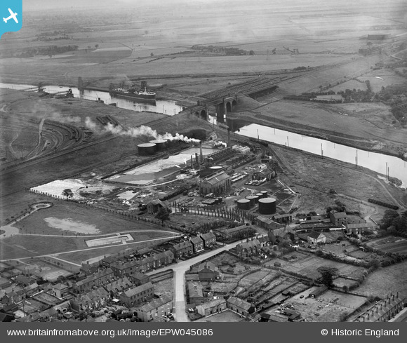
EPW045086 ENGLAND (1934). British Tar Products Ltd and the Manchester Ship Canal, Cadishead, 1934
© Copyright OpenStreetMap contributors and licensed by the OpenStreetMap Foundation. 2024. Cartography is licensed as CC BY-SA.
Nearby Images (7)
EPW045086

EPW045087

EPW045091

EPW045088

EPW045089

EPW045090

EPW045092

Details
| Title | [EPW045086] British Tar Products Ltd and the Manchester Ship Canal, Cadishead, 1934 |
| Reference | EPW045086 |
| Date | July-1934 |
| Link | |
| Place name | CADISHEAD |
| Parish | |
| District | |
| Country | ENGLAND |
| Easting / Northing | 371375, 392064 |
| Longitude / Latitude | -2.430814120079, 53.424334211541 |
| National Grid Reference | SJ714921 |


