
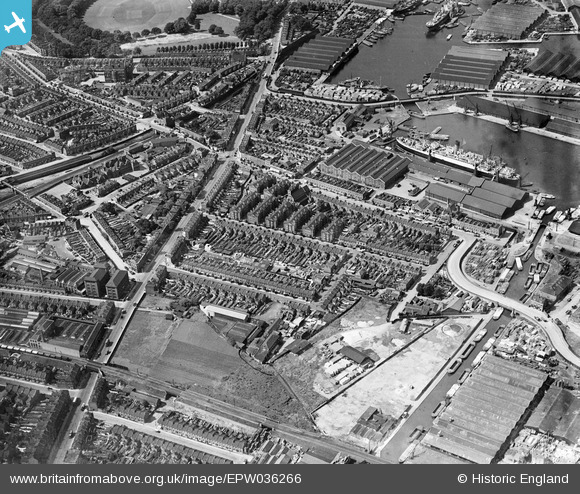
EPW036266 ENGLAND (1931). Sutton Dwellings at Chilton Grove and Lower Road, Rotherhithe, 1931
© Copyright OpenStreetMap contributors and licensed by the OpenStreetMap Foundation. 2024. Cartography is licensed as CC BY-SA.
Nearby Images (19)
EPW036266

EPW036268

EPW035609

EPW035611

EPW035608

EPW035612

EPW036267

EPW036264

EPW035610

EPW036263

EPW035613

EAW033237

EAW033240

EAW033239

EAW033238

EAW033242

EAW033182

EAW033184

EPW044145

Details
| Title | [EPW036266] Sutton Dwellings at Chilton Grove and Lower Road, Rotherhithe, 1931 |
| Reference | EPW036266 |
| Date | August-1931 |
| Link | |
| Place name | ROTHERHITHE |
| Parish | |
| District | |
| Country | ENGLAND |
| Easting / Northing | 536023, 178774 |
| Longitude / Latitude | -0.040484562287455, 51.49104396216 |
| National Grid Reference | TQ360788 |
Pins
 |
 Mike Floate |
Tuesday 6th of May 2014 04:45:22 PM |