
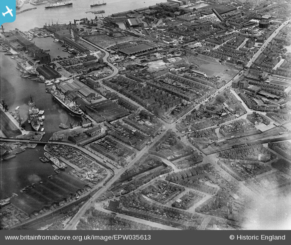
EPW035613 ENGLAND (1931). Lower Road and Sutton Dwellings at Plough Road, Rotherhithe, 1931
© Copyright OpenStreetMap contributors and licensed by the OpenStreetMap Foundation. 2024. Cartography is licensed as CC BY-SA.
Nearby Images (12)
EPW035613

EPW036263

EPW035610

EPW036264

EPW036267

EPW035612

EPW035608

EPW035611

EPW036266

EPW036268

EPW035609

EPW044146

Details
| Title | [EPW035613] Lower Road and Sutton Dwellings at Plough Road, Rotherhithe, 1931 |
| Reference | EPW035613 |
| Date | June-1931 |
| Link | |
| Place name | ROTHERHITHE |
| Parish | |
| District | |
| Country | ENGLAND |
| Easting / Northing | 535893, 178848 |
| Longitude / Latitude | -0.042327640180596, 51.491740284236 |
| National Grid Reference | TQ359788 |
Pins
 Stu Giles |
Saturday 15th of December 2018 04:32:32 PM |